Plataforma sobre Adaptación al Cambio Climático en España

You are here

IRRINET: IT irrigation system for agricultural water management in Emilia-Romagna, Italy

Image from Climate Adapt about this case study
Autor: © Canale Emiliano Romagnolo

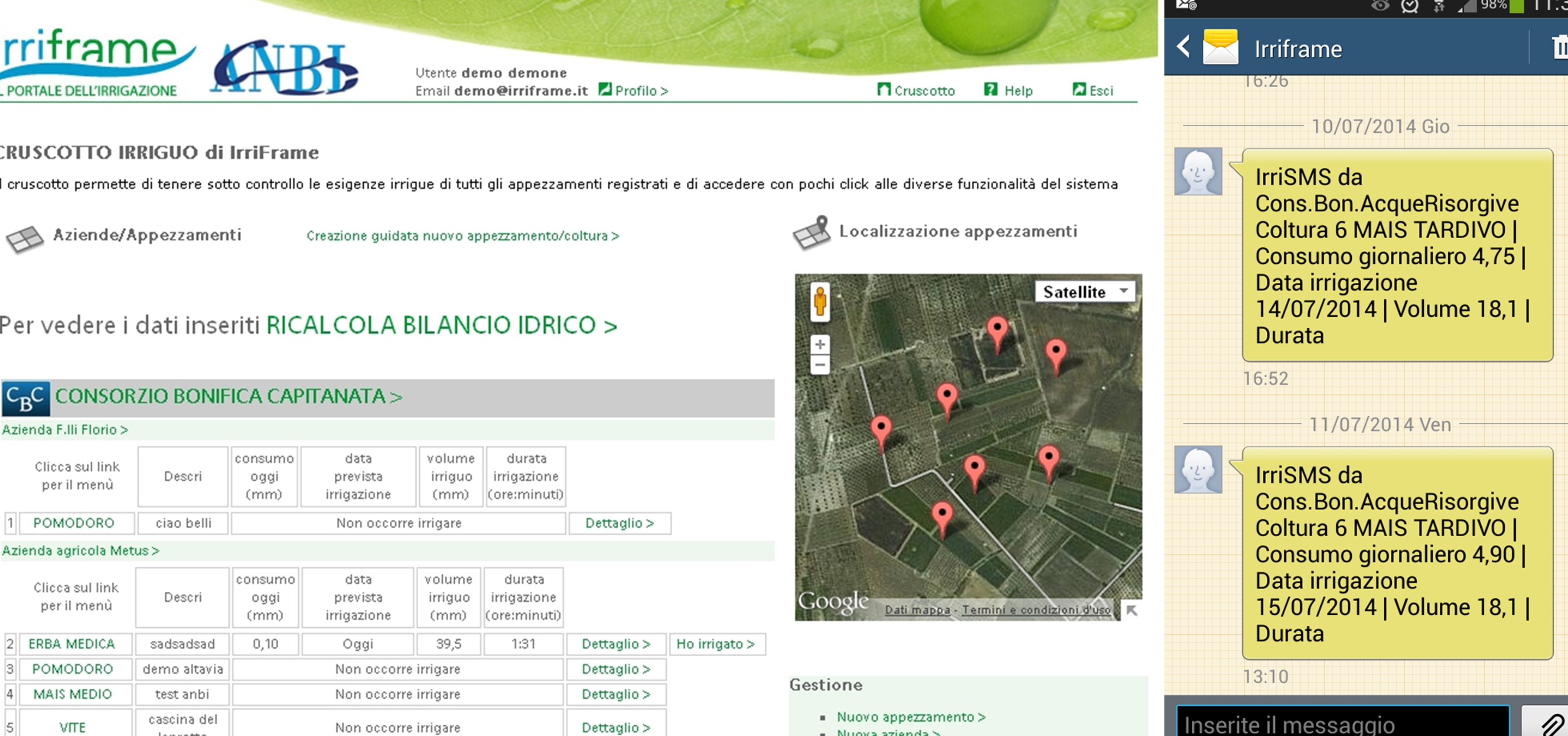
IRRINET is an IT irrigation system aiming to advise farmers on efficient water management. This web service was developed with public funding by the CER (Canale Emiliano Romagnolo, a water consortium located in the Emilia-Romagna region) based on a 1984 project which tested the use of telematics tools in agriculture in Emilia-Romagna. In 1999, with the arrival of Internet, IRRINET started to be developed in a web form and is still active and operative in this Italian region. Considering the increasing need for wise and efficient use of water and the impacts of climate change on water availability, the National Association of Land Reclamation Boards (ANBI) developed IRRIFRAME a similar IT service modelled on IRRINET. In 2014, the Ministry of Agricultural, Food and Forestry Policies identified IRRIFRAME as the most widespread and advanced information irrigation system for farmers in Italy.

In Emilia-Romagna, IRRINET is available free of charge and currently provides more than 12,000 farms with irrigation scheduling on daily basis via a Web interface, SMS and Tablet App. This information supports the efficient use of water resources in the agricultural sector, contributing to cope with water shortage in the light of climate change. IRRINET processes data and information on meteorological (rain and evapotranspiration), soil and crop parameters, whose combination generates the so-called water balance for individual crop, enabling to define the real water demand and save irrigation water without decreasing the quality of crop production. In 2017, it has been estimated that such service allows a yearly water saving of about 90 million of cubic meters (corresponding to 20% of the total agricultural demand) in Emilia Romagna region, without depressing yields.

Case Study Description
Challenges: 

Weather and climate represent key factors for agriculture productivity and their impact on the primary sector is significant. One of the main effects of climatic change consists of variations of productivity and quality of culture due to temperature increase, changes of pluviometric trends and changes in water availability. In July 2018 the Emilia-Romagna region adopted the Regional Adaptation and Mitigation Strategy, which provides a common framework of reference to assess the implications of climate change in the various sectors concerned. The strategy reports about the more recent climate projections for the region: for the period 2021-2050, under the IPCC emission scenarios RCP4.5 and RCP8.5, the minimum and maximum regional temperature are expected to increase about 1.5°C in winter, spring and autumn and about 2.5°C in summer. The temperature increase signal becomes much more intense, between 3°C and 4.5°C, for the scenario RCP4.5 in the period 2071-2100, with peaks during the summer season: the number of days without precipitation in summer is expected to increase about 20%.

According to RCP4.5 scenario the amount of precipitation at the regional level over the period 2021-2050 may decrease during the spring and summer, while autumn may be characterized by an increase (about 20%). A similar signal was found for the RCP8.5 emission scenario, slightly higher for the fall season where the expected increase is around 25-30%.

Changes in the geographical distribution of rainfall in the Emilia-Romagna region have caused significant water deficit in some areas and episodes of water shortage are expected to increase in the future. The availability of water resources is low compared to other regions comprised in the Po Valley and is also affected by losses in the current water distribution system (Programma di Sviluppo Rurale 2014- 2020). Considering climate change scenarios, the region results increasingly exposed to the risk of water deficits, in particular when crops with a spring-summer production cycle are considered. These could be affected by strong decreases of the yields as experienced during the previous drought events in 2003 and 2012, which will be associated to a greater business risk due of the increase in irrigation costs.

Objectives: 

Emilia-Romagna is a leading region in Italian agricultural production with more than 84,000 farms and about 1 million hectares invested. About 33% of the regional farms include irrigated land. In this context it became more and more important to use the water as efficiently as possible. Water scarcity and drought events are increasing in Emilia-Romagna and climate change is expected to worsen such situation, with consequent reduction of the amount of water available for agriculture. Considering the 2012 and 2013 drought events which affected Italy and in particular some areas of the Po valley, the Emilia-Romagna regional authority has put pressure to improve water use efficiency, introducing new criteria regarding water resources governance and management and developing and adopting innovative techniques that may enable farmers to improve overall economic and sustainable production, such as water scheduling.

For these reasons, it is important to estimate quantitatively the anticipated effects of climate change on irrigation water requirements. The IRRINET system provides an answer to this issue, incentivizing an effective use of water resources, without decreasing the quality of crop production. In the long term, and particularly in regard to climate change and variability, IRRINET optimises the use of water resources and sustains agricultural production, especially in dry years.

Solutions: 

IRRINET is an expert-based and free of charge information system for irrigation scheduling which implements the results of more than 50 years of research on plant/water relation and sustainable irrigation management.

Irrigation scheduling is determined applying a complex mathematical model based on daily water balance of the soil-plant-atmosphere system aimed at crop irrigation management at a field scale. Different data and information are combined to estimate the exact volume of water demand, including: how much rainwater infiltrates the ground; simulation of the growth of the plant root system and alternation of the phenological phases; state of water stress in the crop; contribution of underground water and the flow of water through three layers of soil (surface layer occupied by the roots and the underlying layers). In few seconds the weighting of these elements are communicated in form of a short message service (SMS) and information through Web interface and Tablet App. In this way, the growers are equipped with an easy to use and understandable information on how much water their crop has used, how long they need to run their pump or drip system during irrigation and in which part of their property they have to act, thanks to integration with Google maps where the single plot of land is geolocalized.

The data processed by IRRINET are gathered on daily basis and comes from three different sources: the regional Weather Service provides meteorological (rain and evapotranspiration) data; the regional Geological Service supplies soil data and the cultural parameters are provided by the CER.

The IRRINET information systems allows the user to store parameters on yearly, monthly and daily basis and customize the service by specifying additional information on the agriculture plots, types of crop, local soil moisture data, carried out irrigations and local groundwater data.

The first IRRINET prototype, which included a web-interface, was developed by CER in 1999 with the arrival of Internet, based on the outcome of a 1984 project aimed at testing the use of telematics in Emilia Romagna agriculture. In 2009 IRRINET evolved in IRRINET Plus which implements economic calculation of the benefit related to irrigation through a traffic light advisory system. Farmers are stimulated by the economic approach to maximise profit while reducing water overuse. The experts involved in further advancing IRRINET are working on a closer integration with open GIS information layers that may reduce the amount of data the users are requested to register in the system and on the use of satellite information to determine the effective crop coefficients (Kc) for the water balance calculation.

IRRINET service currently involves more than 12,000 farms, covering almost 22% of the irrigated area in the Emilia-Romagna region. In the 2017 irrigation season 28,500 IRRINET SMS were sent and 147,000 irrigation scheduling were produced. IRRINET application in 2017 allowed water saving for more than 90 million m3.

Starting from 2011, a national project called IRRIFRAME managed by ANBI brought the service to all the areas managed by the Italian reclamation boards and irrigation agencies. The IRRIFRAME service is applied in 26,100 parcels all over the Italian country and has been improved year-by-year based on users’ feedback and the outcome of research.

Importance and relevance of the adaptation: 

OTHER_POL_OBJ;

Additional Details
Stakeholder engagement: 

IRRINET was developed and is managed by CER. Starting from 2011 the service has been subsequently supported and co-funded by the Emilia-Romagna Region and ANBI in collaboration with CER, including also EU contribution. Year by year, users feedbacks have driven the evolution of the IRRINET and IRRIFRAME systems.

Success and limiting factors: 

At early 2019, IRRINET-IRRIFRAME is present in 16 Italian regions and involves 69 Land Reclamation Boards and more than 16,000 users, 12,000 out of which are only in Emilia-Romagna region where the service is more consolidated. The key element which made this initiative successful is the simple, with low management costs, user friendly information system that has been set up for farmers to decide when and how much to irrigate. This service is accessible without charge of fees and is tailored for a large number of crops.

Given the direct benefits for the users in terms of water and energy savings, water managers (i.e. Land Reclamation Boards) and water authorities (i.e. the Rural Development Plans of the Emilia-Romagna region) encourage and incentivize farmers to adhere to IRRINET. As stated in the Emilia-Romagna regulations, instead of relying on water for irrigation purposes managed by Land Reclamation Board, IRRINET users are allowed to withdraw surface water from the whole Reno basin during water shortage conditions. Moreover, they are obliged to register to IRRINET in case they are interested to apply for funding from the regional Rural Development Plan.

IRRINET-IRRIFRAME can be easily transferred to other contexts wherever local data are available, in particular to calibrate the model to local conditions. Limitation can for example affect the availability of meteorological data (daily min, max and average temperature and hourly rain) or of georeferenced soil maps. These latter, if available, can reduce the input needs for soil parameters estimation and make output results more robust.

The next challenges for the service evolution will be the integration with sensor and actuator systems, as well as input crop coefficient data provided by remote sensing, to cope with both few information provided by user or available on the area and the needs of more accuracy in soil water content calculation.

Budget, funding and additional benefits: 

Starting from 1999, the IRRINET service has been supported and co-funded by CER, Emilia-Romagna region, ANBI and the European Union. Costs for the development of the (IT) irrigation information system amounted to 200.000 euros including research and test activities. Overall, the platform exhibits very low management costs which is around 0.02 €/ha and the service is provided for free to the final users. 

Legal aspects: 

The Italian Ministry of Agricultural, Food and Forestry Policies uses IRRIFRAME to plan agriculture policies in response to the European Commission's observations about water savings (according to the Water Directive Framework and in response to the requirements of the Guidelines for Water Protection). Additionally, some regional guidelines mention IRRINET - IRRIFRAME as a supporting tool to fulfil the water conditionality of the European Regional Development Fund regulation and respecting IRRINET-IRRIFRAME irrigation scheduling is mandatory for many farmers.

Implementation time: 

The IRRINET system is operative since 1984 with telematics tools and since 1999 with web tools. The extension with the IRRIFRAME system was implemented in 2 years from 2011 to 2013. The IRRIFRAME WEB and APP are currently (early 2019) under an update phase implemented and managed by Agronica Group Srl. A new version will be available by the end of 2019.

Reference Information
Contact: 

Roberto Genovesi
E-mail: genovesi@consorziocer.it  
Stefano Anconelli
E-mail: anconelli@consorziocer.it 
Consorzio di bonifica di Secondo Grado per il Canale Emiliano Romagnolo
Via E. Masi 8, Bologna - Italy
Tel. +39 051 4298811

Gianfranco Giannerini
Agronica Group Srl
Via Calcinaro, 2085 - 47521 Cesena (FC) – Italy
E-mail: giannerini@agronica.it 

Sources: 

IRRINET project, IRRIFRAME project, and Consorzio di bonifica di Secondo Grado per il Canale Emiliano Romagnolo (CER)